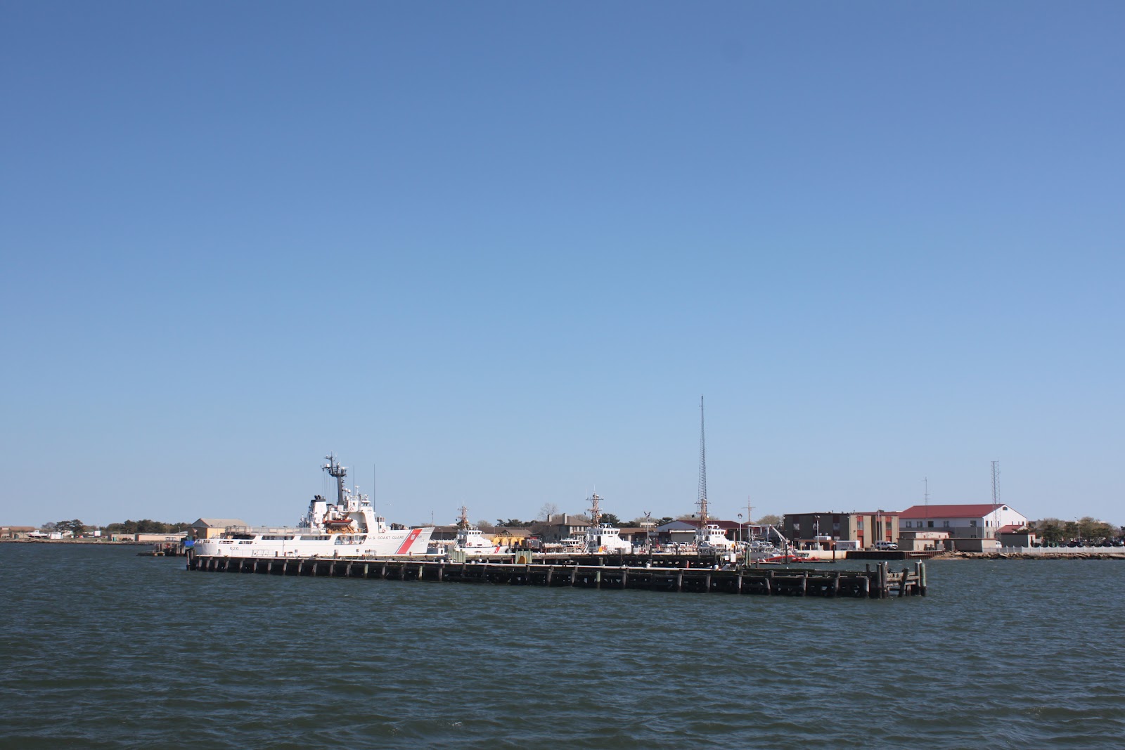
Every once in a while, I get a call to captain an incredible boat. And sometimes, I get the call to captain a challenging boat. In this case, it's Two For One Tuesday!
This mission involves a 1979 Hatteras 46 Convertible for delivery from Key West, Florida to Milford, Connecticut. The trip has a distance of around 1400 miles and this will be my 189th transit from Florida to the northeast.
Okay, I know what you're saying - 1979 Hatteras (ahem!) - built during the AMF years (oof). But, what makes this vessel unique is that in 2009, the boat was completely rebuilt; from the keel up! I mean, this boat is the cat's-ass... check it out!
The previous owner has close to a million dollars into the restoration of this boat. Mind you, it was rebuilt in Key West and some of that might be in "mangrove money," but this boat was stripped, dipped and spanked!!
To start with, the old 375 h.p. smoke n' choke Detroit 8-71s were removed and in their place are two shiny new Caterpillar C-9s at 570 h.p. on Cat's Platinum warranty program (more on this later). The hull, topsides and house where all sanded, faired and painted with all rails and hardware removed... this was done right! A full tower adds to the rakish lines of the boat. And lighting...? She has the atypical squid lights underwater, but what's really stunning, and what got the most comments from dock walkers on this trip, were the blue LED lights from the very top of the tower to the cockpit.
A couple of things to note about the re power - right off the top, there is a weight loss in the engine room of about 1400 pounds. The low profile of the Cat C-9s also makes it easy for a big guy like me to actually get to the outboard side of the engines for maintenance. Out the back of the transmission, the props are coupled to the engine thru the AquaDrive System.

Reports from the new owner, who went to Key West to fish before the boat heads north, was that the boat had some stability issues. Once he returned to Key West, he had the yard that oversaw the rebuild pull the boat out of the water. What was fabricated next was about a six inch extension that ran the full length of the keel, hoping to add some longitudinal stability. Once finished, it was report that on the next sea trial, the boat experienced severe vibration. The boat once again came out of the water, the keel extension removed and back in the water it went. Another sea trial and once again, it was reported to me that there was vibration. That's about the time I head to Key West; having just returned from delivering the 72 Hatteras from St. Thomas.
28 March 2012
0800 It's out the door. I am taking my car to Jet Center at FLL to pick up a Hertz for the drive to Key West. That way, when I fly back at the end of the delivery, my car is waiting for me. With stops for breakfast and lunch, plus traffic, it takes the better part of the day to get to Key West. I arrive at the boat yard to find it deserted and the boat sitting high and dry. So, it's check-in time at the Best Western.
29 March 2012
After breakfast, I head to the boat. I meet the owner of the boat yard, Jim, and we make our pleasantries and discuss the progress with the Hatteras. The boat is sitting in the slings and I sense the anxiousness in the yard to get this boat out of here and confidence that any issues with the boat have been addressed.
Now, I have heard that this boat, with the new engines, will cruise in the top 20's, but looking at this hull in the slings I remark, "this hull isn't designed to do 28 knots!" So, in the water we go and it's down Stock Island Channel at idle. The winds are blowing hard out of the ESE and I know what with this tall tower and this hull, we are in for a ride.
We pick a mangrove channel to the north for some flat water speed runs... the throttles are advanced and at 1600 rpm, the boat starts to vibrate. The throttles advance to 1800 rpm and the bow rail starts to dance. At 2200 rpm my fillings are falling out of my head! The boat heels over hard and it takes both hands to keep the boat going straight. I retard the throttles, look at the yard owner and inform him that I cannot accept the boat in this condition. We return the boat yard and pull the boat.
While it is still dripping wet, I grab a straight piece of wood, grab one end and hold it against the starboard strut and pull the blades of the propeller, one by one, past the end of the stick. It's a poor man's way of gauging to see if one or more prop blades are out of kilter. And sure enough, there was one blade slight out. Over to the port prop and amazingly, it too had a blade slightly out. Upon further inspection, I found a ding in the end of a blade on the starboard prop!
Even though the yard insists that the props were just back after being inspected, I order the props removed and this time, reconditioned! I called Frank and Jimmies in Fort Lauderdale who informed me that there was a truck leaving Key West and that my props would be received in Fort Lauderdale later today. It was promised to me that they would get right on the props tomorrow and I would have them back on Friday. So, with that handled and the boat again out of the water, it's back to the hotel and emailing the owner my findings and action. I am not one for the night life of Key West, so it is dinner at Pepe's and to bed early.
30 March 2012
I head down to the boat to familiarize myself with the redesigned fuel delivery system and layout of the engine room. I also spend much of the day inspecting safety equipment to make sure the boat is in compliance. Just after lunch, I call Frank and Jimmies and I am informed that they have one prop finished, but the computer for the dynamic balance machine took a dump. They tell me that they have a crew coming in to work a half day on Saturday and they will get it done and put it on a truck first thing Monday morning.
The heck with that!!! I tell them that I have a car and that I will be at their back door at 1030 Saturday morning to pick up the props and drive them back to Key West on Sunday. The last thing I want to do is wait for a truck to show up at 1500 hours only to get the props on Tuesday. This way, I can have to props waiting for the yard first thing Monday morning and if nothing else fails, I can be in Fort Lauderdale by Monday night, with the boat!!
So, with an 0400 departure to avoid road traffic, it's an early dinner at El Saboney for some excellent Cuba food. There are about 10 people outside the door waiting to get in... I snuck in the back and grabbed a chair at the bar. Masas de Puerco, yum!!!
31March 2012
0400 I check out of my hotel room and start the drive back to Fort Lauderdale. A stop at Denney's in Florida City for breakfast, I pull into Fort Lauderdale and arrive at Frank and Jimmies just before 1030. Props not quite finished, so I relax in the rental and play a little cribbage on my iPhone (a man has to have game, after all).
About thirty minutes later, I have both props in the trunk of the Hertz and with high-fives all the way around, I head home to my condo to spend the night, thus saving the owner one night's lodging, at least. Sunday morning, I pile back into the rental and drive back to Key West confident that the situation is improving.
01 April 2012
At 0700, I check out of the hotel and head to the boat yard to drop the props off. After breakfast, I return to the yard and make sure that the mechanic dials the tapers on the shafts before we mount the reconditioned props. Once everything chcecks out, it's back in the water with the boat. Today is clear and calm as we head down the channel. Once out front, I advance the throttles and the boat smoothly accelerates through the rpm spectrum with little or no vibration. Satisfied, I take the boat to Oceanside Marina where I have left the rental car in anticipation of a successful sea trial. I give Jim and the mechanic a ride back to the yard. I terminate the rental of the car at Key West airport grab a cab back to the marina. After topping up with fuel, I head out the channel, turn left and set the autopilot to: Fort Lauderdale!

The ride up Hawk's Channel is one of those days you sacrifice a virgin for. Smooth as glass and the water severe clear, as evidenced by this capsized half of a multi-hull I came across.
Nothing better than being underway, I must say. So, with such favorable conditions, I run the boat through various rpm and trim settings to get a handle on the boat to pass on to the new owner. The 1979 Hatteras 46C is a semi-planning modified deep-v hulled boat, for lack of a better explanation, and really was to cruise from 18 to 22 knots. With the higher horsepower Cat engines, the boat will get up to the higher 20's, but the hull lifts up out of the water to the point where the chine of the hull doesn't support the boat and she tends to all off to one side or another; a condition we call "chine-walking." One unique thing about this engine application is that at 1800 rpm, the engines burn 18 gallons per side per hour. At 2000 rpm, 20 gph per side and the same at 2200.
The day turns into a beautiful dusk and I pull into Bahia Mar a little after 2100. I quick hose down of the day's salt and it's to bed.
02 April 2012
On the run up from Key West, the were a couple small issues that the owner wanted me to correct in Fort Lauderdale. The autopilot was not interfaced with the GPS and one of the cameras was not broadcasting thru the boat's Magellan Paradox system. A call to my friends at Concord Marine Electronics (954-779-1100) and a technician was scheduled for the following day.
03 April 2012
The interface was a no-brianer, just a data cable to purchase and the GPS and autopilot are happily in conversation. The camera issue is another story. Suffice it to say that the owner, for the time being, will only be able to view the engine room (important) and the main salon via the internet (a piece of tape over the salon camera, no spying on the deliery captain!) and the aft deck camera lead will need to be addressed in Connecticut.
The fuel dock at Bahia Mar opens at 0900. the fuel dock at Lauderdale Marina open at 0600. So, with ships business concluded, I set the alarm for 0500.
04 April 2012
It's still dark as I cast off from Bahia Mar and reposition to Lauderdale Marina for diesel. By 0700, I am underway up the coast in flat calm water. My intended destination is Cape Canaveral - maybe Ponce de Leon to the north if time allows. At 1300 I pass the cape and angle in close to the launch facility. NASA has already disassembled one of the two shuttle launch pads. it brings back memories of three shuttle launches in the past that I have been fortunate to observe while transiting a couple of miles offshore. By 1530, I am abeam of Ponce Inlet and just can't bring myself to head in. The boat is cruising nicely, the weather cooperating and I'm burning daylight! I put in a full day pulling into St. Augustine Municipal Dock at dusk. A quick hose down and short shower, and it's across the street to O.C. White's for dinner. Then to bed.
05 April 2012
0630 I leave the boat in search for breakfast. Upon return, a fuel hose is dragged to my slip and I fill the tanks. I am passing under Bridge of Lions and I get a low fuel pressure alarm on the starboard engine to I pull of to the side of the channel and drop the hook. And inspection of the RACOR filers shows about half an inch water in the bottom of the bowl indicating to me that when I switched to the forward tank the day before, there appears to be contaminant there. I swap out the RACORS on both sides but still have a LFP alarm in the right engine. Not wanting to renegotiate the city dock single engine with the strong current there, I head to Conch Harbor and make a flawless single engine dock maneuver. A call to the Cat Concierge (see, I told you we would get to it) and in about an hour, a Cat tech is on board pulling the secondaries (no filter wrench on board), blowing out the fue line then a download on his computer and the boat is back in operation.

The weather forecast is for "sporty" in 24 hours and I am hoping to get up to Hilton Head before the bottom falls out of the glass. On my way out of St. Auggie, I am happy to see that the Army Corps of Engineers is spending some money on the inlet.
But with half the day wasted due to contaminated fuel, I head to Fernandina for the night as it is a good, all weather inlet, day or night. In fact, up the St. Mary River, which is the inlet, lies the US Navy's King's Bay submarine base. 1730 and I am tied up at th City of Fernandina's municipal marina.
06 April 2012
I leave out early in the morning under freshening conditions. I am not at all confident that I can make Hilton Head offshore.
At 0930, I am abeam of St. Simon's Sound and the wind has picked up out of the northeast; the wind waves are making the ride uncomfortable. I grit my teeth and hold on until Sapelo Sound where I spot a larger sport fisherman farther out to sea sending up huge bow spray and the decision is simple... take her in.
The ICW through Georgia is a winding, twisting route. A good watch must be maintained when transiting the several large sounds. Many tributaries lead inland and it is not too difficult for the novice to run up the wrong river. Just remember, Red Right is Wrong on the ICW. Check the markers with a pair of binoculars. The ICW markers will have a piece of yellow reflective take above the marker numbers, square tape for green and triangle tape for red. If you keep the green markers on the ocean side of the channel (that's on the right northbound), you'll do fine.
Around 1500, I pass thru Thunderbolt, the closest point on the ICW to Savannah and I press on for Hilton Head arriving just after 1800. I am directed to my slip by the dock hand in a Boston Whaler and signed in at the slip, accepting the proffered complimentary bottle of wine for the owner (I don't drink alcohol). With an hour and a half of daylight left, I give the boat a long, fresh water rinse. Hilton Head is one of my favorite stops along the route... great docks, excellent restaurants and rocking chairs everywhere to sit and people watch. Tonight is stunningly beautiful under a full moon.
07 April 2012
0700 I reposition the Hatteras over to the fuel dock to top up the two "saddle tanks." I have determined that the forward tank will be unused due to it's contamination. This will require me to fill up the saddle tanks each day for the remainder of the trip. The owner has suggested that I stop along the way to have the tanks cleaned, but I have vetoed that suggestion. Better to keep the boat moving and address this issue at the final destination. Besides, it's a beautiful morning on the ICW and I have miles to go before I sleep. Underway as before, ops normal!!
With Georgia behind me, I look forward to the course straightening out somewhat more than the switchback channels between Florida and Hilton Head. There is still a bit of a lump outside, so my intended target is Georgetown, north of Charleston.
Mid-day finds me passing thru Charleston Harbor, then north along a several miles stretch of no-wake zone at Wild Dunes and back on the throttle up and across the Santee River tributary.
There is one section here where I was once southbound in the fall with a pilot I once flew air ambulance with, Chuck Landan as crew. We were in a Sea Ray 540 Sedan Bridge, humming along at 28 knots when we heard two muffled blasts followed by what sounded like rain hitting the isinglass curtains. A quick look behind us and there was a guy in a camouflaged boat, with fake reeds and grass, and he was anchored on the side of the Intracoastal Waterway! Not up on of the many tributaries, but right on the channel. Anyway, I called the U.S. Coast Guard in Charleston on VHF and informed them that we had been shot at - gave them the location - and they said they would check with South Carolina Department of Natural Resources. Well, 5 minutes go by and the Coast Guard comes back to me and says, I swear, this is the truth - DNR asked if I would go back and get the registration number off the front of the boat that shot as me!!
A couple hours later and the ICW joins the Winya River and I arrive at Georgetown at dusk. Harborwalk Marina is the only place I tie up here as it is the closest marina to main street. Georgetown's claim to fame is that this area was once the second largest producer of rice in the United States. In fact, there is a rice museum here. There is also The River Room, a very fine restaurant which will please nearly every palate. I highly recommend a stop in Georgetown, just to dine at this wonderful establishment!
08 April 2012
0600 and it's still dark outside! After the obligatory engine pre-start checks, it's underway once more. The weather offshore has improved considerably overnight and so I head down the wide Winya River ship channel out to sea. a mariner's note here: There are submerged breakwaters on both side of long entrance from sea. Especially if you are approaching from the south, make sure you pay special attention to the chart. For over 100 years, many a hapless sailor has run afoul on this underwater jetty.
Once clear, I turn to port and set the autopilot to Cape Fear River, about 96 miles distance. The run up the Cape Fear River, across Snow's Cut then up the ICW to Wrightsville Beach is about 22 miles. At Wrightsvile Beach, I exit Masonboro Inlet and run another 93 miles to Beaufort N.C. for overnight dockage. For those that imbibe, make sure you get your "wooden tokens" for free beer at the Dock House Bar. For me thought, it's a walk across the street to Rib Eyes for salad bar and 20 ounce slab of meat!
09 April 2012
I get an extra hour's sleep this morning as I have to wait for the dock office to open and giveme a hand with my lines at departure. There is a strong current that run through the marina and running solo makes this the safe option.
Once underway, the route runs up Adam's Creek and out into the Neuse River which is at the bottom of Pamlico Sound. Each time I run up the Neuse, I remember a night in late March 1996 when I anchored for the night in the middle of the dark, wide river and spent hours with a pair of binoculars, on by back, studing the Comet Hyakutake as it made it's near Earth transit on it's way around the sun. I was captivated by the fact that the next time this comet would re-enter the inner solar system would be in 70,000 years. That night ranked right up there with seeing shuttle and rocket launchs from Canaveral, or humpback whales breaching in Cape Cod Bay.
At the junction of the Neuse and Pamlico Sound, one could turn left and continue up the protected ICW. Or, on a nice weather day, a run up Pamlico Sound past Manteo Island and into Albemarle Sound makes for a stress free run on autopilot. Plus, no need to come off throttle when meeting slower traffic. Just don't forget the 45 foot fixed bridges on the west side of Roanoke Island.
Passing inside Cape Hatteras, you will more than likely see a car ferry running back and forth to the mainland. And, you will find a military target range for the Marine Corps and Navy pilots flying out of Cherry Point. Just make sure you make clearing turns before getting this close.
After clearing Roanoake Island, head up Albemarle Soung to Camden Point and rejoine the ICW at Mile Mark 65. This will make it 15 miles to the next stop at Coinjock. "Where the Hell is Coinjock?" is a world famous marketing legend.
Louis Davis, the owner of Coinjock Marine, has 1200 linear feet of dockage with a convenience store, fuel, laundry, showers and a restaurant the serves "the best prime rib in the world." In fact, you can get a 32 ounce choice cut of cholesterol free (yeah, right!) slab of beef if you are so inclined
Look for the red buildings on the east side of the ICW at Mile Marker 50. But, it is highy recommended that you make reservations for dockage well in advance of your arrival. When I docked (after making reservations the day before), there were only four boats on the dock. Before the sun went down, Louis was bunching up the boats and filling the 1200 feet of dock with last minute arrivals. This place fills up during transit season! Call them at 252-453-3271 or visit their web site at www.coinjockmarina.com.
10 April 2012
If northbound, make sure you check the bridge schedules leading into Norfolk. North Landing, Centerville, Great Bridge, Steel Bridge and Gilmerton all have restrictions during morning and evening rush hour traffic. The Jordon Bridge in Norfolk has been removed. Check your waterway guide for bridge schedules or, if you don't have a guide, Coinjock has a hand-out they give to boaters with the bridge schedules and mile markers.
It takes a good 5 hours to clear all the bridges and Great Bridge Lock from Coinjock. Once thru the Gilmerton, it's mostly no wake all the way to Portsmouth and Mile Marker 0. Pulling into Tidewater Marina, I stop to top up with fuel. I have about six hours of daylight. The weather offshore is "sporty" so I decide to head up the Chesapeake Bay.
I get out into the mouth of the St. James River and it's blowing down the bay at 20-25 knots. This has created a wind wave of about 3-4 feet which, in the shallow water of the Chesapeake, is like putting 3 foot concrete blocks in front of your car and stepping on the gas.
I hang on at 12 knots for a few miles more until I get to the mouth of the Rappahannock River and I cannot see straight from all the bouncing around!! So it's off of the water and into Deltaville Marina. Very friendly marina staff and owner, being that it is still early in the season, I couldn't have been treated better. The marina has a nice captain's lounge and a large selection of bicycles to borrow and ride the country road into the village.
11 April 2012
Well, there were gale warnings up last night but the winds have subsided to 20 knots with higher gusts. No guts, no glory... I head out once more to see if I can hug the western shore and make it to Annapolis.
Rounding Windmill Point I set a course to Smith Island Light 20 miles to the NNE and I'm taking the four footers on the port beam. With the full tower, it's a wild ride!!
In about an hour I can see the lighthouse off of Smith Point where all of a sudden I get an overheat alarm on the port engine. Shutting the engine down, I hop off of the flying bridge and open the engine room hatch and I am met with the smell of coolant...not a good sign. I climb back up the ladder to the helm, check the chart and give my Cat Conceirge a call. Just off to port is the Great Wicomico River and a marina I have frequented in the past in Reedville. The entrance to the river is straight forward, but if transiting this area at night, a radar is required as there are fish traps along the route.
Entering Ingram Bay I turn right up Cockrell Creek and, the old fish rendering plant, menhaden fishing fleet and slide up to Reedville Marina. A call in advance had the owner on the dock grabbing my lines. Once tied up next to his Crazy Crab Restaurant, I asked him what time does the restaurant opens? "Friday," was his reply. Seeing as how it was Wednesday, other arrangements will have to be made. The only other restaurant within walking distance opens on Thursday. It's not the end of the world, but you can see it from here.

I grabbed my iPhone and entered "restaurant' in the map app and the only other restaurant is 7.1 miles away. 'What the heck..." I give them a call and, explaining my situation. I ask if they had someone who would pick me up. Not exactly a usual request, they had no one there to come get me. So, I settle into the notion that tonight's dinner just might consist of Cheezy Poofs and Red Bull when, about an hour later, I get a call from a nice little old lady who said she was the mother of the owners of the restaurant I called and asked if I still wanted to be picked up for dinner? 30 minutes and a narrated tour of Reedville later, I am sitting at the Little River Market and Deli drooling over a delicious double bacon cheese burger and sweet iced tea. Pecan Pie for dessert? Yes, please!! Once gestation was completed, I happily was escorted back to the car and driven back to the boat. I nearly had to beat my hosts over the head to accept a $20 tip.
12 April 2012
As I had mentioned, I had called the Cat Conceirge after I had shut the engine down and headed to Reedville. What he did was call the local Cat rep, Ampro Diesel, and apparently told them to drop what ever they were doing and get someone to my boat; because not only did I receive a call from a nice lady at Ampro yesterday on my way in, they had "Mike" at the boat by 1000 this morning. Pulling the inspection plate on the raw water pump found the impeller in good shape, Mike pulled the belt guard off the front of the engine and found the a bolt for the "idler" on the belt drive had snapped. And while the raw water pump is gear driven, the jacket water pump (coolant) is belt driving. So this meant that the coolant wasn't circulating and thus the engine overheated. Mike didn't have a the bolt on hand (remember, engine is under Platinum Warranty) but he would come back in the morning, install the new bolt and clean up the coolant that had sprayed around the engine.
.jpg)
.jpg)

The one good thing about this is that it's Thursday... and the only restaurant within walking distance of the boat is OPEN!! Tommy's Restaurant is only open Thursday thru Sunday and is a nice upscale restaurant and bar over-looking the water. Terrific food and fellowship, I had a nice conversation with a couple of retired airline flight attendantsin for a meal and drinks. You can find Tommy's at www.tommysrestaurant.net
On the walk back to the boat, I noticed a crab boat working it's way home. I looked up the name on the Coast Guard data base and noticed that this boat was built right here back in 1946. I also see on my iPhone that there is a Reedville Marine Railway... well I just have to check this out... and right there... a local crab boat on the 'way! There is just something about marine railways that interests me more than a modern boat yard. Maybe it's the fact that these people are craftsmen working with wood; who build boats with old world tools and techniques.
Sibley 41
13 April 2012
Like clockwork, at 1000 Mike is back aboard and working on the port motor. Weather forecast for tomorrow calls for calms and after Mike finishes up with the motor, cleaned up he coolant and downloaded of engine data to his computer, I decide to wait until morning to make a day run of it. The good news is that the computer data showed that the engine never got above 220 degrees (after I shut it down) and Mike said I did everything right. Thank you Ampro for your quick attention.
14 April 2012
Up before dawn, I am off the dock at sunrise. All of the engine parameters look good as I pass Smith Point and head north towards my next fuel stop at Tolchester, on the upper bay.
I arrive at Tolchester about 0830 and there is a slight delay in getting fuel... just enough time for me to wolf down a hot dog and Red Bull. After topping up with diesel, I quick turn back out onto the upper portion of the Chesapeake Bay and head into the Chesapeake and Delaware Canal.
Back in the 90's, I looked forward to doing the C & D Canal with a stop at Chesapeake City on the north bank. This is where the famous Schaefer's Canal House was located. Great food, great German chocolate desserts and if you're lucky to arrive on a Thursday night, the $25 all you can eat seafood buffet! What was really cool was that when big ships would transit the canal, the ship pilots from the Chesapeake and Deleware Bays would do the swap in front of the restaurant. Schaefer's would have the name of the ship, it's cargo and destination and would announce it thru the restauant on the PA system. Shaefer's has been closed since 2006 and many have wondered if it would every reopen. Hooters was going to buy the place and open a retaurant here, but nearly every homeowner in town had a No Hooters sign planted in their yard and Hooters pulled out. But, passing by today saw a flurry of activity. A yell across the water to what looked like a foreman replied that the place was scheduled to re-open by the end of the month. Awesome!!

I exit out the Delaware Bay side of the C & D Canal at Reedy Point and point to bow down the bay past the cooling towers of the Salem Nuclear Power Plant. It's a 54 mile run down to Cape May, NJ.
At 1600, I enter the western entrance of Cape May canal and once in the harbor, I see I have a couple of hours of day light left. I by pass the Coast Guard base and exit out the main ship channel into the Atlantic.
Keeping land on the left, I spot whale spouts off of Wildwood Beach while I run the 38 miles up to Absecon Inlet and Atlantic City, New Jersey. The visability is so clear, I can actually see the tall hotels from 30 miles away!! A call to Farley State Marina reserves me a slip across the street from what was once called the Trump Marina hotel and Casino. It is now a Golden Nugget.
Once tied up and cleaned up, I head across the street for a buffet dinner... mis-take! The food was horrible. There is a Chart House restaurant on the marina side (no salad bar!) but I was trying to save the owner a saw-buck. Once the buffet was forced down, there was nothing left to do but hit the craps table.
20 minutes later, and $200 richer, I am satisfied with playing with the house's money and head back to the boat and bed.
15 April 2012
The only good thing about a casino is that you can get food 24 hours a day. So, at 0600 I grab some breakfast, head back to the boat and got underway before 0800. A call to the owner to update him was met with surprise that I spent night at ACY andot Cape May, as planned. The fact that I might be at his marina by the end of the day... a day earlier than planned... was good news!
Passing Barnegat Light, I know it's only a matter of a couple hours before I reach the top of the Jersey Shore and enter New York Harbor. I travel under the Verrizano Narrows Bridge and hug the right shore are I pass between Governor's Island and Brooklyn and pass under a bridge o the same name up the East River.
This is one of my favorite parts of a Florida to northeast delivery. Running up the east river. Looking at all the city dwellers looking back at me in wonder as I fly past Wall Street, throwing a wake on the UN and negotiate the whirlpools of Hells Gate. This is FUN!!
Before too much longer, passing Ricker's Island Prison and watching airliners cross in front of me as they land on the runway in the bay at La Guardia, I'm passing under Throng's Neck bridge and out into Long Island Sound! And the sound is flat like a lake.
The Legend of Execution Rock: In the waters of Long Island Sound off the coast of New Rochelle, NY, low tide reveals a group of menacing and jagged rocks. Known as Execution Rocks, condemned Revolutionary War prisoners and Colonials faced death in these unforgiving waters at the hands of British soldiers. Chained here at low tide, fated prisoners slowly drowned as the tide rose.
Port Washington to starboard, Mamaroneck and then Greenwich off my port, 33 miles to go!! I call the owner and he is elated! At 1730 I enter Milford Harbor and right there, on the end of the the dock is Chris, the owner, greeting me and his new boat to it's new home.
EPILOGE - It's not over just yet...
So, it's the end of the day. I need part of tomorrow to washdown the boat and go over the accounting of the trip. Chris says that since it's the weekend, he is going to let me borrow his car so I can get around Milford and such. We walk up to the parking lot and hehands methe keys to his Mercedes SL-63 AMG.
What they should call it is the SL-63 OMG - Oh My God!!! With 613 hand made horsepower under the hood of this roadster, I asked Chris, "Which is more valuable to you, the boat or the car? Because I got your boat from Key West to here without a scratch, but I can't guarranty anything about the car!" An incredible machine, you hit a button and it's like something out of a Transformer movie; switching from hard-top and convertible. One thing though... very hard to keep the wheels from spinning after coming to a stop at a light :-D I can't think better way to go to the laundry!! And Milford? Pretty little New England town.
So, with the delivery of Head Hunter concluded, the boat washed down and my weekend in Milford finished, I check into the Crowne Plaza in White Planes in preparation for my early Monday morning flight home.


.jpg)
.jpg)